Lake Tahoe Winter Storm Watch: Up to 3 Feet of Snow and 80 MPH Winds Could Disrupt Travel
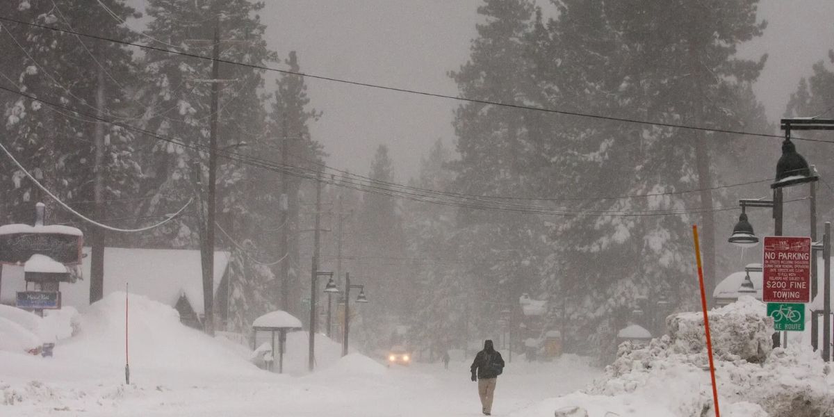
A powerful winter storm is heading toward the Lake Tahoe region, bringing the threat of heavy snowfall, strong winds, and dangerous mountain travel conditions. The National Weather Service (NWS) has issued a winter storm watch as forecasters warn that some areas could receive up to 3 feet of snow, while wind gusts may reach 80 mph.
The developing weather system could create major problems for drivers traveling through Truckee, South Lake Tahoe, and the Sierra Nevada mountain passes. Monday’s commute may already become difficult, with a stronger storm expected to arrive Wednesday into Thursday.
Lake Tahoe Could Receive Up to 3 Feet of Snow
The first round of winter weather is expected to bring accumulating snow to higher elevations. A winter weather advisory is in effect from 10 p.m. Sunday through 7 p.m. Monday.
According to the forecast, snowfall totals could include:
- 3 to 7 inches above 7,000 feet.
- Up to 1 inch near lake level.
- Strong ridge-top winds reaching 70 mph during the initial system.
- Potentially heavier snowfall during the midweek storm.
The National Weather Service’s Reno forecast discussion describes the approaching system as a “stronger, colder storm mid to late week.” Snow levels could drop to approximately 3,500–4,500 feet Tuesday night, potentially affecting lower-elevation communities.
Monday’s Commute Could Become Difficult
Travelers may experience hazardous conditions during both Monday’s morning and evening commutes. Snow-covered roads, reduced visibility, and powerful winds could make driving challenging.
The NWS warns that “Travel could be very difficult to impossible” during the stronger midweek storm.
Forecasters expect a temporary break in the weather on Tuesday before the next system approaches. However, travelers should not assume that conditions will remain safe throughout the day.
Important Travel Information for Drivers
| Travel Detail | Expected Conditions |
|---|---|
| Region | Lake Tahoe and Sierra Nevada |
| Initial Snowfall | 3–7 inches at higher elevations |
| Midweek Snowfall | Up to 3 feet possible |
| Potential Wind Gusts | Up to 80 mph |
| Stronger Storm | Wednesday into Thursday |
| Snow Levels | 3,500–4,500 feet possible |
What Should Drivers Do Before Traveling?
The NWS advises motorists to “Slow down and use caution while traveling.”
Drivers should consider these precautions:
- Check road conditions before starting their journey.
- Carry appropriate winter driving equipment and tire chains.
- Avoid unnecessary mountain travel during severe conditions.
- Monitor official weather alerts and changing forecasts.
- Consider postponing trips if conditions deteriorate.
California travelers can check Caltrans QuickMap, while Nevada drivers can use Nevada 511 for current road conditions and restrictions.
What Happens Next?
The biggest concern remains the stronger storm expected Wednesday into Thursday. Heavy snowfall and powerful winds could significantly affect transportation across the Sierra Nevada. Travelers should monitor updated forecasts and avoid relying on Tuesday’s temporary improvement when making mountain travel plans.
Stay Updated with LifeScienceReport.com
For more important weather developments, breaking news, and the latest updates from across the United States, visit LifeScienceReport.com. Stay informed and follow the stories that matter.