Colorado Snowpack Shows Sharp Divide as Northern Mountains Face Expanding Extreme Drought
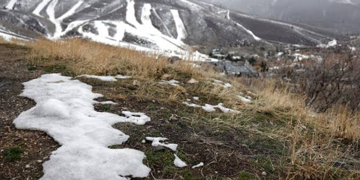
Colorado’s mountain snowpack is showing a dramatic contrast between northern and southern regions, with several northern monitoring sites reporting little to no snow water while parts of the southern mountains are approaching four times their normal levels. The uneven conditions come as extreme drought expands across the northern Rockies, raising concerns about water availability heading into the winter season.
Extreme Drought Expands Across Northern Colorado
The U.S. Drought Monitor map released on November 19, reflecting conditions as of November 17, showed extreme drought expanding across parts of Larimer and Grand counties. According to the Kiowa County Press, most drought categories across Colorado changed only slightly during the latest reporting period, while the northern mountain region experienced worsening conditions.
Summit County continues to face particularly severe conditions, with exceptional drought affecting 88% of the county and extreme drought covering the remaining 12%.
Colorado Snowpack and Drought Conditions
| Region or County | Reported Conditions |
|---|---|
| Summit County | 88% exceptional drought, 12% extreme |
| Larimer County | Extreme drought covers 89% |
| Grand County | Snowpack readings between 0% and 44% of median |
| Eagle County | Snowpack at 20% of median or less |
| Boulder County | Most sites below 50% of median precipitation |
| Routt County | Snow water equivalent below 1.5 inches at all sites |
| Southern Mountains | Snowpack at roughly 150% to nearly 400% of median at many sites |
Northern Mountains Report Low Snow Water Levels
Provisional readings from the Natural Resources Conservation Service’s SNOTEL monitoring network showed that most sites in Grand, Summit, Eagle, Larimer and Boulder counties had less than one inch of snow water equivalent, with several locations recording zero.
Snow water equivalent measures how much water is stored within a snowpack. It is an important indicator for forecasting water supplies, runoff and potential seasonal water availability.
Since the water year began on October 1, precipitation levels have also remained below normal at many northern monitoring locations.
- Most Summit and Larimer County sites received less than 70% of median precipitation.
- Most Grand and Boulder County locations recorded less than 50% of median precipitation.
- Eagle County snowpack readings were at 20% of median or lower.
Southern Colorado Mountains Show Much Stronger Snowpack
The southern mountains are experiencing a considerably different pattern. Monitoring sites in San Juan, Mineral, La Plata and Hinsdale counties reported snow water equivalent levels mostly well above their historical median.
According to the reported NRCS measurements, many sites reached approximately 150% to nearly 400% of median levels. Wolf Creek Summit recorded 9.7 inches of snow water equivalent.
Precipitation since October 1 at the cited southern monitoring sites ranged from 2.4 to 4.7 times the median.
What Does This Mean for Colorado’s Water Supply?
The contrasting snowpack conditions highlight the importance of continued monitoring as the winter season develops. Mountain snow is a critical source of water for Colorado communities, agriculture and ecosystems.
The current readings are provisional, and additional snowfall could significantly change conditions over the coming weeks. However, expanding drought and low snowpack in the northern mountains remain important concerns.
Stay Updated with LifeScienceReport.com
For more weather news, environmental updates, drought developments and important stories across the United States, visit LifeScienceReport.com. Stay informed with the latest developments affecting communities and natural resources.